Originally published on 24 October 2024
The ability to capture and reproduce real-world environments in 3D is rapidly becoming democratized.
What once required drones, planes, or specialized scanners can now be done with the phone in your pocket.
Three primary methods dominate the space today: LiDAR, photogrammetry, and Gaussian splatting. Each comes with unique strengths, limitations, and use cases.
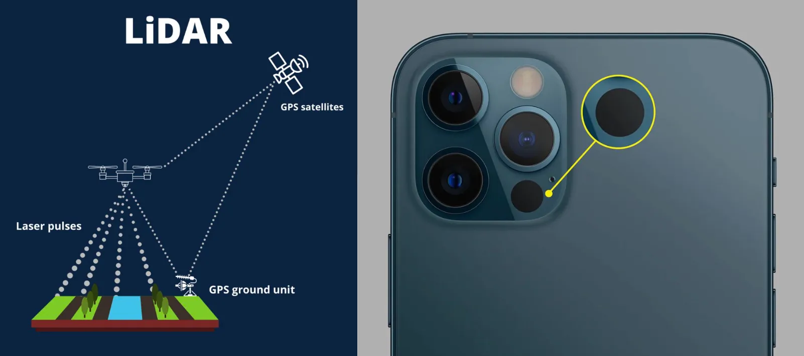
LiDAR (Light Detection And Ranging) is a technique for creating accurate 3D representations of objects and environments.
A LiDAR-equipped device emits infrared light pulses, which hit and reflect off nearby surfaces. By measuring the time it takes for the light to return, the device calculates the distance to objects and builds a precise depth map.
Many modern smartphones are equipped with LiDAR scanners. iPhone 12+ Pro and Pro Max models are all LiDAR capable.
This accessibility means that mapping is no longer limited to professionals. Anyone with a smartphone can be a MeshMapper.
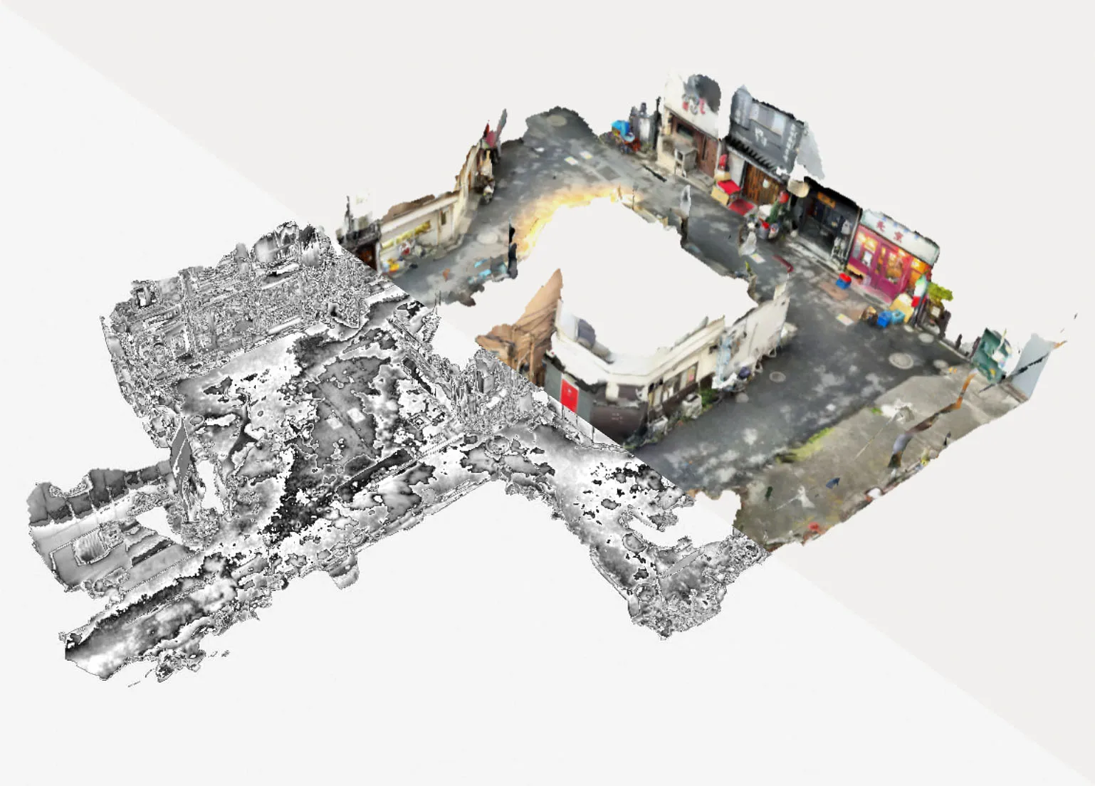
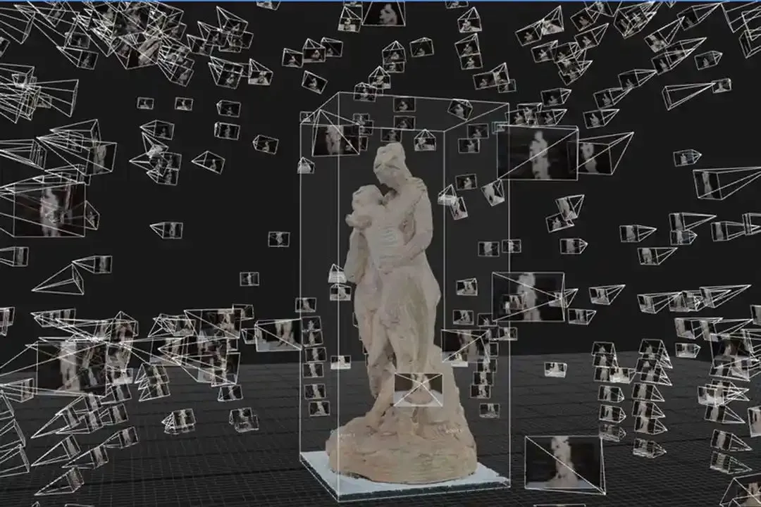
Photogrammetry constructs a 3D model by analyzing a collection of 2D photographs. Specialized software identifies key points across overlapping images and triangulates their positions to generate an accurate reconstruction.
Since photogrammetry only requires a camera, virtually any device can be used; from DSLRs to smartphone cameras. Wide-angle lenses are particularly helpful, as they increase overlap between photos, improving the overall accuracy.
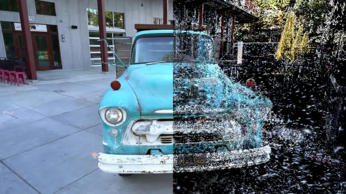
Gaussian splatting is a newer rasterization method that uses dense point clouds of “splats” (colored, semi-transparent points) to render highly photorealistic 3D environments. Unlike LiDAR and photogrammetry, it does not generate a polygonal mesh.
Any camera can be used for Gaussian splatting since the input is a set of regular images.
The best choice depends on what you are scanning and what you plan to do with the data.
LiDAR is best for quickly capturing spaces, large structures, or environments where geometry matters more than texture. Ideal for construction, navigation, and AR mapping.
Photogrammetry is best for detailed, textured models of objects and environments, especially when realism is important. Popular in gaming, film, and cultural heritage.
Gaussian splatting is best for immersive visualization, rapid capture, and situations where photorealism is the goal, even without a mesh. Great for VR/AR scene previews.
Some guiding questions:
Today, anyone can capture 3D scans with mobile apps. Polycam, Immersal, Scaniverse, and Pix4D offer methods including LiDAR scanning, photogrammetry, and Gaussian splatting.
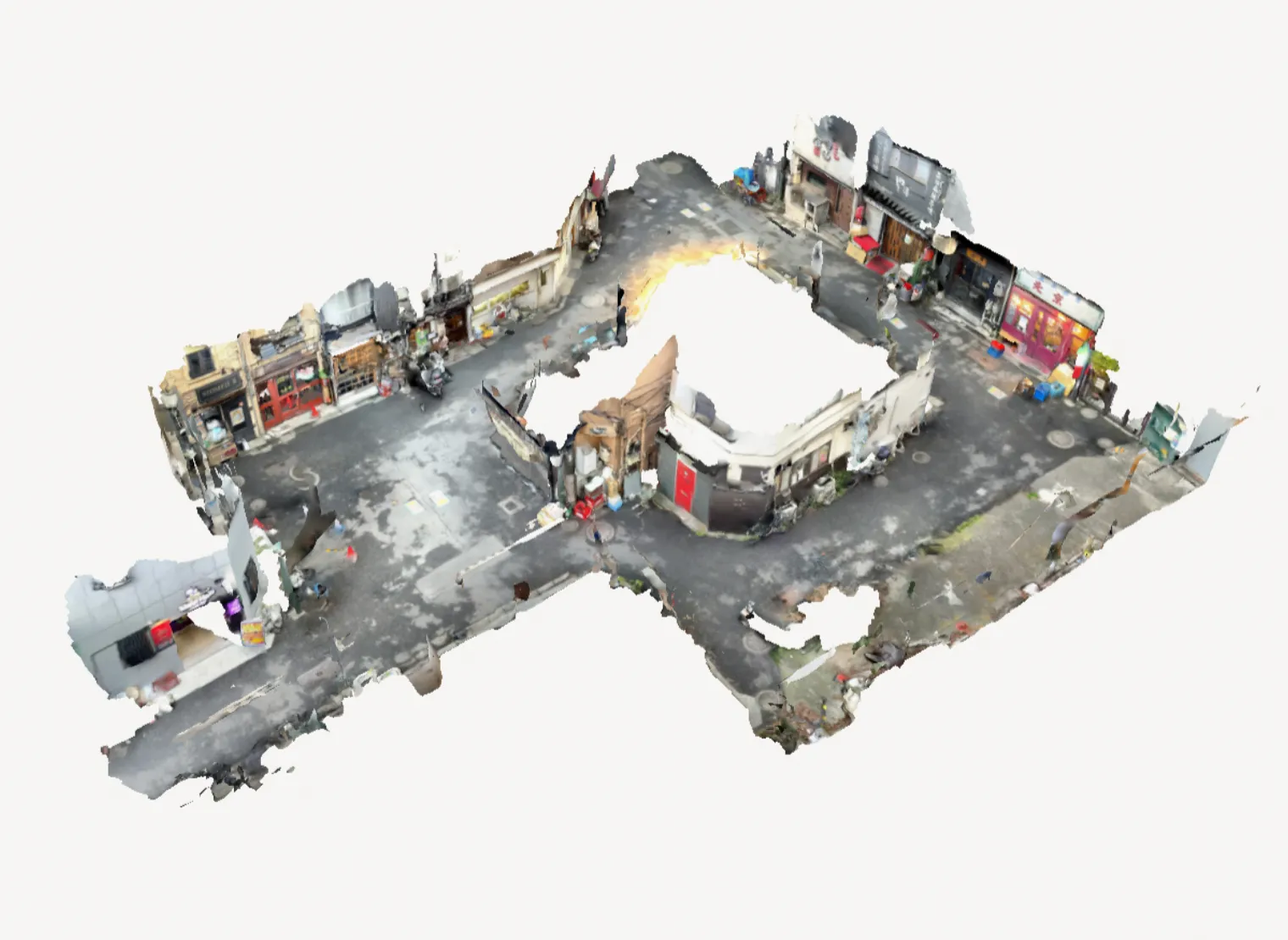
For larger projects, there are of course professional handheld 3Dscanners, such as the Leica BLK2GO, Eagle, and XGRIDS, which enable much farther and higher detail captures.

Once you’ve captured a scan, you can submit it to the MeshMap web app. Upload your mesh along with metadata such as map name, coordinates, time of day, and weather.
This ensures your scan can be used seamlessly within the MeshMap ecosystem.
The rise of LiDAR, photogrammetry, and Gaussian splatting is lowering the barriers to 3D scanning.
Whether you’re a hobbyist capturing your neighborhood, a developer integrating real-world data into AR, or a professional creating large-scale digital twins, these methods offer different tradeoffs.
With smartphone access and tools like MeshMap, mapping is no longer limited to specialists. Anyone can contribute to building a shared 3D map of our world.
For more information on mapping and XR, stay tuned for a future blog comparing professional scanning rigs.